In the year 1973 the United States military, the Department of Defence, launched the project known as GPS.
GPS was not a new concept to the US, as there were multiple predecessors and technology advancements that lead up to the project.
GPS dates back to the era of the Cold War when the USSR launched the satellite Sputnik.
Two American physicists were able to pinpoint where the Sputnik satellite was along its orbit due to ‘the doppler effect‘.
This realization gave the US an idea. What if it could be used to track points around the Globe?
It was at this point that the United States Department of Defense made the decision to use satellites for a proposed navigation system.
And thus, with the launch of Sputnik, the space race had officially began.
With what started as a method of studying the Earth from space, it swiftly became a universal technology used by almost every country in the world.
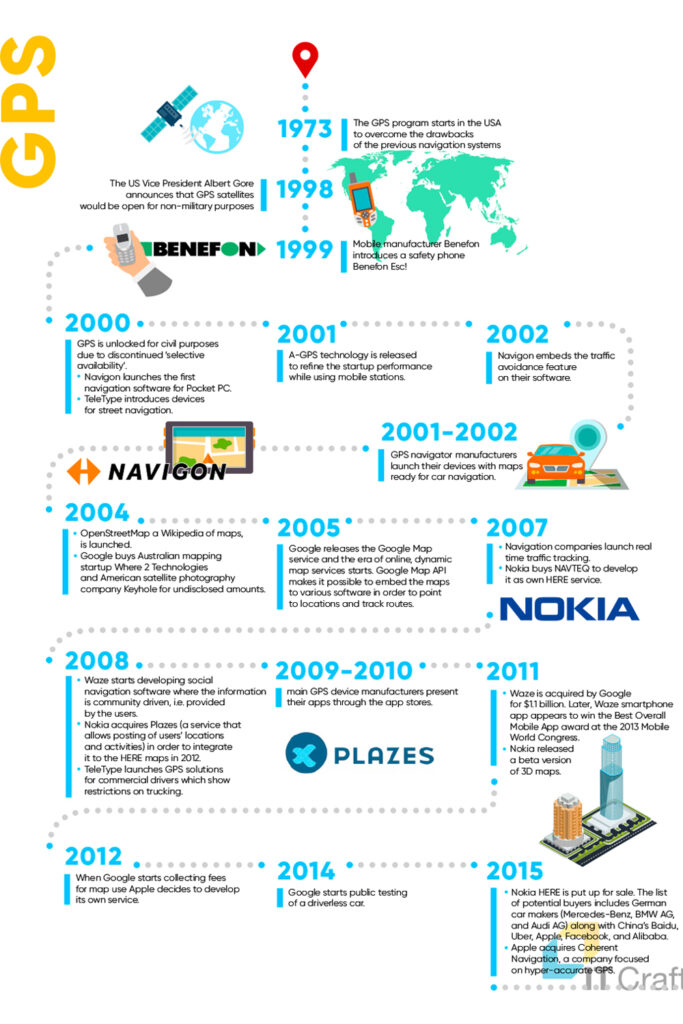
The GPS Timeline

1973
The US military begins the GPS project, a system designed to be superior to technology previously being used.
1993
The United States releases their 24th satellite, signalling the completion of the constellation.
1998
United States President Al Gore authorizes GPS satellite use for civillian use.
Previously GPS was only available for US military purposes.
1999
Mobile phone manufacturer Benefon releases their safety phone titled ‘Benefon Esc!’
2000
GPS is now available for civilian use.
Navigon software releases the first navigational software for the PocketPC product.
Teletype releases devices for road navigation.
2001
Assisted GPS using mobile networks is becoming common technology to improve startup performance of GPS devices.
2001-2002
Manufacturers of GPS navigator products launch their devices with in-built maps, ready for vehicle navigation.
2002
Navigon software proceeds to embeds traffic avoidance features on their application.
2004
Open Source Software OpenStreetMap is launched, a community driven mapping software in contrast to Google Maps.
Google purchases ‘Where 2 Technologies’, and Australian Mapping Startup and American satellite photography company ‘Keyhole’.
2005
The era of online dynamic map services begins with Google releasing their Google Maps services.
The Google Map API allows embedding maps into software in order to track routes and direct to locations.
2007
Real time traffic tracking is becoming main stream with navigation companies.
Nokia purchases NAVTEQ to rebrand as their Nokia HERE service.
2008
The company Waze begins to develop their social navigation software where traffic information is contributed by the users.
Mobile phone company Waze aquires Plazes; a service that allows users to share their location and activities; part of their integration plan with Nokia HERE maps.
Company TeleType releases their GPS solution which allows truck drivers restrictions on commercial trucking.
2009-2010
Manufacturers of GPS devices begin to list their newly created apps within the stores.
2011
Google acquires Waze for $1.1 billion.
Waze wins the Best Overall Mobile Phone application award at the Mobile World Congress.
Nokia releases their beta version of 3D mapping.
2012
Apple begins to develop it’s own mapping service as google begins to start charging for their mapping services.
2014
Google starts testing publicly autonomous driving technology.
2015
Nokia attempts to sell their HERE system. Potential buyers include Mercedes, BMW, Audi, Baidu, Apple, Alibaba and Facebook.
Apple acquires the company Coherent Navigation.
Conclusion
The United States Military began the GNSS GPS project in 1973, and by 1978 they had proceeded with launching their first satellite.
In 1993, close to 20 years later, the 24th and final of the satellites had been launched into the Earths orbit, signalling the completion of the constellation.
GPS remains to this day a space-based radio-navigational system with multi-uses, owned and operated by the US Air Force, but available for everyone to use.
