The Global Positioning System (GPS) is a Global Network Satellite System
For GPS to work, it requires satellites, ground stations and devices that receive positioning information.
Satellites send signals to gps enabled devices, which are used to determine their location.
Infrastructure known as Ground stations are strategically spread across the continents help to keep the satellites synchronized, as well as control their orbit.
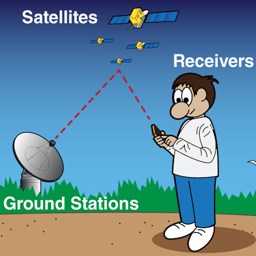
A gps device, or receiver, like you might find in your phone or in your parents car, is constantly listening for a signal from these satellites.
A receiver can calculate its positioning once it has signal from four or more satellites, using a method called trilateration.
Velocity, location and elevation data is collected from multiple satellites in order for trilateration to be performed, allowing a precise location to be determined.
What makes up GPS?
- Satellites
- Send GPS signals to GPS enabled devices
- Ground stations
- Keep the satellites synchronized, maintaining integrity of data, and thus ensuring location information that the satellites are sending is correct.
- GPS enabled devices
- Receive GPS signals from 4 or more satellites, with each signal compared against the rest to determine positioning, using a method called Trilateration.
- If altitude is known, 3 satellites is all that is required.
So how does it work?
All all times there are satellites orbiting around the world, which are sending signals that are read and processed by a GPS enabled device.
These devices are either situated on the Earth, or near to the surface. In order for an accurate location to be calculated, the GPS device must be able to receive signal from four or more satellites.
A single satellite is not able to provide useful location information.
Satellites do not give off information regarding angles, so one satellite communicating with a GPS device is able to determine only that the location is somewhere within the surface area of the sphere.
- One satellite places you within a sphere
- Two satellites place you within the intersection of two circles
- Three satellites places you on two possible points of the three intersecting circles .
- Four satellites give you the exact location.
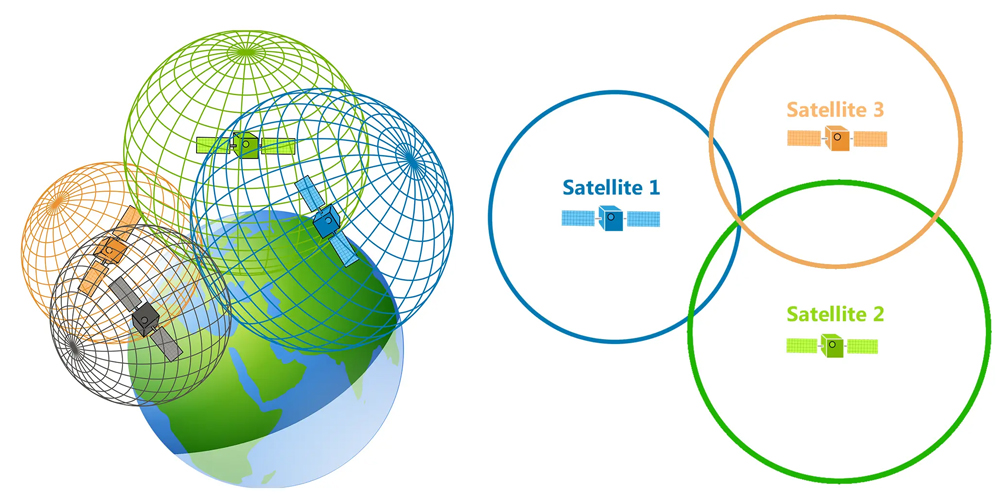
Right image: 3 satellites to determine a device location when altitude is known.
The fourth satellite is not always necessary in scenarios where you already know the altitude.
For example, when you drive, you can use the level of the ground as the last intersection.
This cannot be done when in a plane, as you are not bound to the ground.
At any point, a device can read GPS signals from six or more satellites.
Twice a day each satellite in the constellation circles the earth, with each satellite sending a unique communication of orbital parameters and time.
Conclusion
GPS Satellites are in orbit around Earth twice per day, with each of them sending their own unique signal.
As satellites are moving in different directions, covering the entire globe, a user with a gps enabled device receives the signals at slightly different interval; one message each from least 4 satellites.
After the gps enabled device receives these four signals, the precise location of the device is able to be determined.