Assisted GPS aGPS
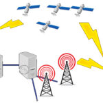
Assisted GPS, sometimes known as Augmented GPS (aGPS/A-GPS) is the technology of improving the performance for obtaining initial location data from satellites.
The initial startup performance of obtaining a satellite signal lock is often referred...
Geocode
Geocoding, or address geocoding, is the conversion process of text-based location description, and returning latitude & longitude co-ordinates.
The most common text-based location description would be an address.
An example of the geocoding...
Geozone & Geofence
A geozone or geofence is a virtual perimeter configured for a real-world geographic area
Geozones are primarily created within mapping applications by setting boundaries by using either of the following:
GPS Co-ordinates Street addresses
The...
Reverse Geocode
Reverse geocoding is taking a latitude and longitude location and converting it to a human readable address, or location name.
This allows the identification of nearby road addresses, points of interest, parks and other various locations.
Addresses...
Time To First Fix - Hot Start, Warm Start, Cold Start.
Time to First Fix (commonly abbreviated to TTFF) is the process of time in which it takes a GPS enabled device to obtain signal from enough satellites to determine accurately its location.
A GPS receiver must have three sets of data before it can...


