Reverse geocoding is taking a latitude and longitude location and converting it to a human readable address, or location name.
This allows the identification of nearby road addresses, points of interest, parks and other various locations.
Addresses are commonly split into street number, name, suburb/city, state and country.
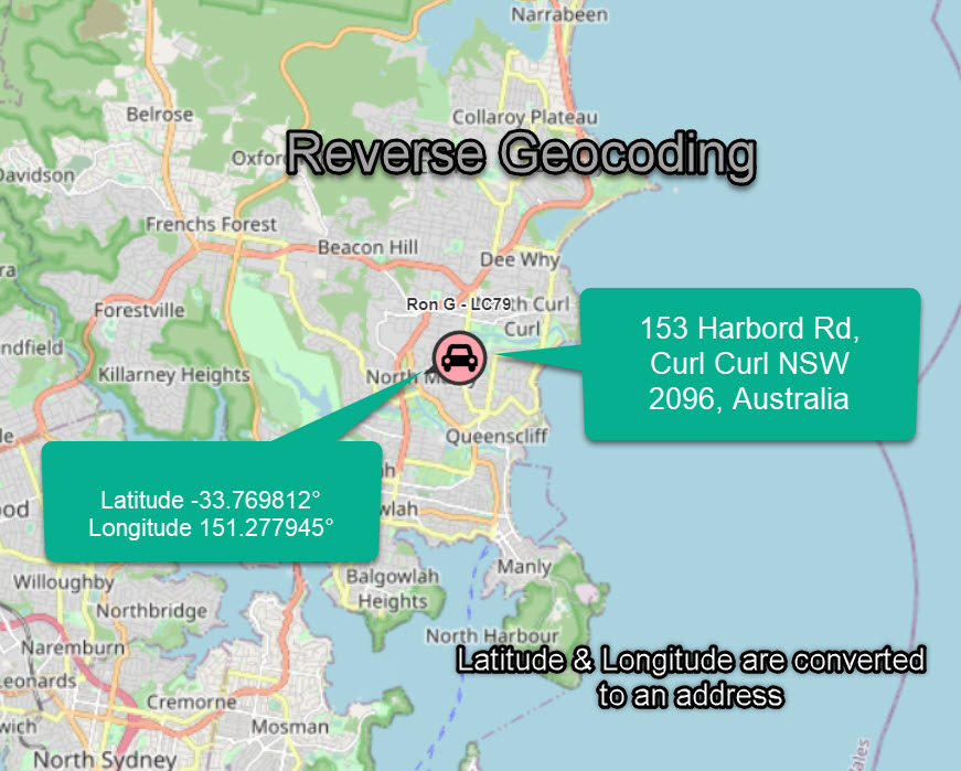
Reverse geocoding is an important component of location based services, including gps tracking, mobile and Emergency Services to convert latitude & longitude into a human friendly address which is easier to locate by an end user.
Reverse Geocoding Services
Public reverse geocoding services are now becoming increasingly available through niche companies supplying GIS related data and processing methods, such as APIs.
These services can work automatically through an API, or by users manually through the input of a gps co-ordinate.
API Based Reverse Geocoding
Many applications require automatic and programmable access to reverse geocoding in bulk.
There are many services available which can work with reverse geocoding via an API.
One such example of an API reverse geocoding service is LocationIQ.
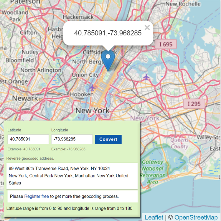
Web Based Reverse Geocoding
There are free web based reverse geocoding services online. These services take a manual latitude & longitude address and convert it.
https://www.latlong.net/Show-Latitude-Longitude.html
Conclusion
Reverse geocoding is the process of converting GPS co-ordinates from latitude & longitude numbers into human friendly addresses.
It is an important part of gps tracking, emergency services, gis and other mapping software.
Reverse geocoding is not limited to streets only, but can also be used to identify a ship in a canal or lake; as it makes more sense to describe a ship location using nautical map identities.